
ANNA ORCZEWSKA
University of Silesia,
Faculty of Biology and Environmental Protection, Departament of Ecology;
Bankowa 9, 40-007 Katowice
e-mail: anna.orczewska@us.edu.pl
Description popularizing the research project
It is very important so that a map was up-to-date. It would be perfect if it was updated last month, if it showed the latest piece of a highway, refreshed touristic trails, new camp sites and bike routes, petrol stations, one way streets and radars. In times when the GPS is so common, the above mentioned criteria for a map are essential if we want a driver to
have a look at it.
Usefulness of a map older than 2 years is doubtful, if it was published before 2000 it is absolutely useless. At least for a driver.
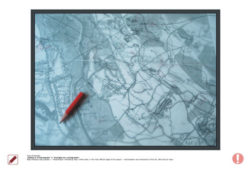
Do maps dated 200-250 years back have any practical use for a contemporary man? It turns out that they are invaluable as far as ecologists and botanists are concerned. Such maps allow them estimate original area and age of the forest cover, before it had to recede giving room for highways and petrol stations.
It is very valuable information to know which fragment of the forest is the true ancient one. The woodland showed in 18th century maps is probably even older and may be a fragment of the primeval
forest. These are the fragments which tell us the most. In case of logging or degradation, these will be the chance of the forest rebirth. Finally such a fragment is an ideal reference point for comparative researches on forests of the same type in other parts of the country or a continent.
It is not easy to use a historical map. It was created as accurately as it was only possible without satellite images.
It is very important so that a map was out-to-date. As much out-of-date as it is only possible, it would be perfect if it was dated a few hundred years back. It would be perfect if it was without roads, highways and ring roads of huge metropolis. Only in the oldest map you can find what is lost in maps of 2008, fragments of the primeval forest.
Abstract
In contemporary studies in woodland and forest ecology knowledge of the history of forest cover is becoming more and more important. It appears that forests and woods
which have existed for a long period, for at least 200-250 years, are far richer in herb layer woodland flora than forests planted in more recent times, on former agricultural land. Thus, an interest in historic maps, which allow us to get to know the changes in forest distribution in the landscape, is growing among woodland ecologists and botanists.
The aim of the detailed cartographic studies which were undertaken, was to follow and describe the changes in the history of land use and to estimate the age and the former use of forests of the chosen areas of the Oleśnica Plain (Opole Silesia) and Żmigród Valley (Lower Silesia) (southwestern Poland). The maps originating from the 18th, 19th, and 20th centuries, were compared. Digitalization of the three layers was followed by their intersection, which resulted in a very detailed map, illustrating the age and origin of forests, and changes in the forest distribution in the areas studied.